
Real Spooks © 2012 Cynthia Kinkel
Nothing survives to mark the graves of the souls lost in that place,
… nothing perhaps, but a secret mark, that time cannot erase.
Twenty miles east of Savannah, Tybee is the most northerly of Georgia’s “Golden Isles.” A small strip of land juts westward from the island into a vast area of coastal marshlands. This strip which also has immediate access to the Savannah River shipping channel, became the location for two consecutive quarantines that operated during the late 1700s into the early 1800s.
The first, located on the tidal creek that now bears its name, was simply called a ‘lazaretto.’ At the end of the eighteenth century, it housed unfortunate European immigrants who contracted contagious diseases on board ship during the transatlantic voyage to America. It was also the ‘welcoming station’ for a host of African slaves who emerged from the cargo holds after the treacherous middle passage.
Like all seaports, Savannah could ill afford contamination of the mainland, so incoming vessels experiencing outbreaks of deadly scourges like yellow fever and cholera were required to unload the sick and cleanse the decks before continuing up river to port. Sometimes they were forced to remain at the mouth of the Savannah River for months before given clearance to proceed.
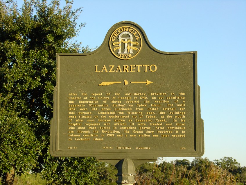
The present-day Italian term lazaretto, or lazaret simply translated means ‘hospital,’ but in the Middle Ages it literally meant ‘pest house’ – a place for those dying from the plague or leprosy. Derived from the Hebrew word lazar, or leper, it also refers to the biblical figure, Lazarus, the one that Christ raised from the dead. Research also indicates that remote portions of the first quarantine, a 104-acre tract purchased in 1767 from patriot, Josiah Tattnall probably served as a leper’s colony.
After continuous use throughout the Revolution, the Savannah Grand Jury reported the first site in ‘ruinous condition’ in 1785, so it was abandoned, and a new site opened across the way on nearby Cockspur Island. In 1954, the Georgia Historical Society placed a marker (pictured here), at the original site’s general vicinity along U.S. Highway 80 East.
