A Light on Fort Mountain

Cabin at Fort Mountain“A QUEST FOR A FIRMER FOUNDATION”

So,… Who ARE the Moon-Eyed people? Will we ever know?

My first encounter with the subject came one evening in 2000 while I was reading the first chapter, Prehistoric Settlers, of a book by Clifford S. Capps and Eugenia Burney entitled Colonial Georgia, published in 1972 by Thomas Nelson, Inc. It was only a brief mention, but it immediately captured my attention.

Colonial Georgia - Capps & BurneyFor thousands of years before the dawn of written records, the Southeastern United States was home to humans that history traditionally called ‘Indians,’ (thanks to Christopher Columbus). Only fairly recently in the modern scheme of things did they acquire the definitive status of indigenous peoples or native Americans. Prehistoric Georgia has been inhabited for at least 17,000 years, throughout the Paleoindian, Archaic, and Woodland periods, as evidenced by sites along the Macon plateau at the fall-line. Archaic period pottery found in a mound at Stallings Island near Augusta indicates it may be one of the oldest mounds to be confirmed in North America, ALTHOUGH the base of another mound near Savannah’s Irene site, known as the Bilbo Mound, may be even older — it’s been dated at 3,540 B.C.

Capps and Burney begin by classifying the early inhabitants of Georgia as Wandering Hunters, Shellfish Eaters and Early Farmers who lived in small familial groups, employed limited farming skills, and hunted fish and game along the major waterways. The evolution of various Southeastern Native American cultures from the Archaic Period to the Woodland Period was marked by the emergence of three stages of ‘Pre Columbian’ occupation, dating from 1000 B.C. to 1000 A.D. It was during these final years of pre-history that some say the subsistence of the nomadic hunter-gatherer was replaced by woodland farming.

CULTURAL REGIONS OF THE NORTH AMERICAN INDIANS

Cultural Regions of the North American Indians

Achievements credited to the “Neolithic Revolution” of the Early Farmers include more substantial dwellings and permanent settlements, decorative symbolic pottery (Swift Creek & Weeden Island — Middle/Late Woodland Period), limited agricultural advancements, and the use of the bow and arrow. They also participated in the broader AdenaHopewellian and Fort Ancient trading cultures.

Hopewell_Exchange_Network_HRoe_2010

Hopewell Interaction Sphere & Trade Network (Heironymous Rowe, 2010)

Along the Etowah River southwest of Cartersville, Georgia, in Bartow County, the Leake Mounds site contains the remains of a prehistoric occupation that lasted from approximately 300 B.C. until 650 A.D. A major center during the Middle Woodland period, it figured prominently in the interaction among peoples throughout the Southeastern and the Midwestern United States. Swift Creek pottery has been discovered throughout a major portion of Georgia as well as portions of surrounding states, and the Leake site is at the northernmost edge of its distribution. 

interaction-movement-small

Swift Creek pottery has been discovered throughout Georgia as well as portions of surrounding states. Leake (red star) was at the northernmost edge of distribution.

The handiwork of these prehistoric peoples may still be seen at sites such as the Eagle Effigy Mound at Rock Eagle near Eatonton, at numerous stone effigy sites across North and West Georgia, and along the Chattahoochee River, as noted researcher and CEO of The Apalache FoundationRichard Thornton describes, “a 310 mile long line of important towns and mountaintop shrines were described, which run from the mouth of the Apalachicola River to a stone architecture observatory on Ladd’s Mountain west of Cartersville, GA. Most of these towns and shrines were apparently constructed between around 0 AD and 600 AD. That certainly was the case for the two largest Woodland Period towns north of Mexico . . . Kolomoki in SW Georgia and Leake Mounds in NW Georgia.” 

Capps and Burney note that somewhere around 900 A.D., “a group of migrants known as the Master Farmers, the Moundbuilders, began to extend their culture into the state of Georgia, gradually displacing the Early Farmers who had lived and hunted along the Ocmulgee River for a thousand years.” There is some speculation as to what the real impact these so-called Master Farmers had upon what was already developing in Georgia at the time toward the establishment of permanent settlements, organized societal ‘chiefdoms, and major trade networks. Exactly how these former local tribal identities began to unite into regional cultural/agricultural/religious collectives is still being evaluated. There’s no doubt however that more decorative ‘riverine’ and marine shell pottery, ceremonial copperplate engravings, and elaborate burial practices emerged in the region during this period, along with the introduction of intense collection and/or horticulture of starchy seed plants such as maize (corn), squash, and beans. Massive earthen ceremonial mounds like the ones at Etowah near Cartersville, and Ocmulgee in Macon are impressively larger. Similar structures may be found from northern Vermont to the major trading center known as Cahokia in western Illinois, south to the Gulf of Mexico, and as far west as the Rockies. 

(77280.ngsversion.1422280964335.adapt.768.1)

Cahokia Mounds State Historic Site – (Photograph by Ira Block, National Geographic)

ocmulgee-national-monument

Ocmulgee National Monument in Georgia – (Photograph from Trip Adviser)

Concerning the site at Ocmulgee, Capps and Burney state the following: “Ocmulgee was the center of Indian culture in Georgia at the time of the Master Farmers (around 1100 A.D.), who developed a form of civilization as advanced in many respects as any to be found north of Mexico. We do not know what happened to the Master Farmers. They lived less than two hundred years at Ocmulgee, after which the site was deserted for more than 250 years.”

There is still debate concerning the possible fate of these large population centers and trade networks throughout North America, but researchers suspect that certain factors facilitated an earlier transition from the Adena/Hopewell/Fort Ancient networks during the Woodland Period to the era of these ‘Mississippians.’

Sudden and extreme changes in climate that began around 535 to 536 A.D. were in varying degrees affecting populations on a world-wide scale including an extremely cold, dry snap caused by ashes or dust thrown into the air after the eruption of a volcano. It’s also speculated that around 539 A.D., the impact of a comet or meteorite in the southern Atlantic brought huge tsunamis to the southeast Atlantic and Caribbean coastlines. Such probable events drastically affected the Northern hemisphere for many years, and contributed to famine, disease, increased political turmoil, migrations and warfare across the globe.

Here’s this from Fundar.org.sv: “The greatest atmospheric aerosol loading event of the past 2000 years occurred in the year ca. A.D. 536. A ‘dry fog’ enveloped much of the earth and was followed by protracted global cooling lasting more than a decade from ca. A.D 536-550.”

Such events quite possibly ushered in the Middle Ages in Eurasia, and the era of the great plagues. The ‘dust event’ dropped temperatures, changed weather patterns, and brought major societal changes, also to China, the Mediterranean, Scandinavia, and North and Central America.

Evidence has been found of another meteor disaster that took place in the year 1014 A.D. when “a swarm of large meteors or comet debris struck North America and the Atlantic Ocean, causing both a mega-tsunami, and local, cataclysmic meteor damage.” The event, that may have brought destruction upon the Ocmulgee Earth Lodge, also greatly affected the British Isles and North Sea countries. Additional volcanic activity is thought to have resulted in climatic changes to the American Southwest, near Flagstaff, Arizona, beginning around 1100 A.D. Not long afterward, a series of heavenly events, including the dramatic appearance of Haley’s Comet, and a ‘guest star’ documented by Chinese astronomers, “coincided with the equally sudden florescence and eventual fate of a sophisticated, vibrant but mysterious civilization in the American Southwest known as the ‘Anasazi’.” (Joseph, Frank, 2009-12-21, Advanced Civilizations of Prehistoric America: The Lost Kingdoms of the Adena, Hopewell, Mississippians, and Anasazi (p. 176). Inner Traditions/Bear & Company. Kindle Edition.)

Meanwhile, according to Georgiaencyclopedia.org: “The Late Woodland subperiod, A.D. 600–900, is perhaps the most poorly understood portion of Georgia prehistory. The available evidence suggests that some of the trends of the Early and Middle Woodland subperiods may have been reversed during this interval, while other trends may have continued or even intensified… One of the trends that diminished was mound construction. Earthen mounds were constructed during the Late Woodland subperiod in Georgia, but the pace of construction appears to have diminished greatly from the preceding Middle Woodland. Along with this came a decrease in the trade of exotic items. Although the exchange of marine shell may have increased during the Late Woodland in some parts of the Southeast, there is little evidence of this in Georgia. The extensive regional trade in copper, rocks, and minerals that developed during the Middle Woodland subperiod declined precipitously in Georgia and throughout most of the Southeast during the Late Woodland… Corn agriculture became important in many parts of the Southeast during the Late Woodland. Until recently, the archaeological evidence for this in Georgia was equivocal. Recent excavations have revealed, however, that the growing of corn may also have become prevalent in Georgia during the Late Woodland, particularly in the northern part of the state and near the end of the period… The appearance in the archaeological record of small triangular stone projectiles suggests that the bow and arrow may have been adopted during the Late Woodland. Previously, stone points had been hafted on spears or small darts. The use of the bow and arrow no doubt facilitated the hunting of deer and other animals… The bow and arrow also may have made warfare more deadly. Perhaps not by coincidence, the first fortified settlements appeared during the Late Woodland at about the same time as arrow points. Fortifications included ditches and palisades of wooden posts. With the exception of these few fortified settlements, however, Late Woodland subperiod sites are generally small, and probably included no more than twenty dwellings. Excavations have revealed both circular and square or rectangular houses… The increases in warfare and corn agriculture during the Late Woodland subperiod set the stage for the final period in Georgia prehistory. The Mississippian Period would be marked by a continuation and elaboration of these trends.”

The whole of the Mississippian Period lasted about eight hundred years (800 to 1600 A.D.), and gave rise to some of the most complex societies that ever existed in North America. However, the culture was already in decline across the Midwest and the Northeast before the Europeans arrived, as chiefdoms with large population centers were broken apart into smaller ones. In Georgia, these smaller chiefdoms were evenly distributed across the state’s river valleys, and their individual cultures continued to evolve throughout areas of the Southeast up until the time of the Hernando de Soto expedition (1539 –1541). The early ‘gold-seeking’ Spanish explorers reported encountering numerous native settlements in North Georgia, but by the mid 1600s, even these populations had mysteriously vanished. What happened during the missing hundred years of historical accounting concerning their fate, and whether they were lost to disease or something worse is still under investigation. According to *Richard Thornton, “the famous 16th century English historian, Richard Hakluyt, hinted that there was more going on in the interior of the Southeast than is taught to American school children. He tells us that some traders from Santa Elena (South Carolina) made secret journeys to North Georgia between 1567 and 1584, but there is no official record of Spanish, French or English colonial activities in the Appalachian Mountains of Georgia until 1646. However, from the 1570s onward, French maps labeled the region as containing gold and silver.”

Whatever occurred, the increasing presence of Europeans, and the new alliances formed with the remaining smaller chiefdoms throughout the region including a lucrative Indian slave trade, eventually brought all of the elements of the former Mississippian culture to an end.

A map showing a proposed de Soto Expedition route, based on the 1997 Charles M. Hudson book "Knights of Spain, Warriors of the Sun". (Permission details CC-BY-SA-3.0; Released under the GNU Free Documentation) License.

– Proposed de Soto Expedition Route (Heironymous Rowe, 2008)

A most comprehensive map of eastern North America was created by a Virginia physician and botanist named John Mitchell (1711–1768). It depicts in great detail the territories and regions of the colonial era, and attempts to place native inhabitants by tribal names in the places where they were found at the time. The map is fascinating, and was, for many years considered the most reliable recorded typographical source in colonial America. Even the smallest inscriptions and notations can easily be read if you zoom in on it, but of course it only tells part of the story…

Regardless, it’s a marvel for its time.

The Mitchell Map

The Mitchell Map, published by John Mitchell on February 13th, 1755 as, “A Map of the British and French Dominions in North America.”

The Capps and Burney narrative in Coastal Georgia has a brief mention of the Creek and Cherokee Indians in the state, and an even briefer mention of the Uchee Indians (Euchee or Yuchi). As if the various spellings of this tribe’s name weren’t confusing enough, up until recently only a sparse amount of information was available about them. (The above map refers to Euchee settlements with varied, similar spellings.)

While Colonial Georgia simply states “the Uchee lived along the banks of the Oconee, and at the headwaters of the Ogeechee, Chatanooga, and Savannah Rivers,” their presence has been confirmed farther south on the islands of Wahale or Guale, including Tybee at the mouth of the Savannah River. Fact is, Tybee Island wasn’t just a regional hunting and fishing ground. It was the place to collect a commodity that was precious and abundant: sea salt.

Years ago, (as the newspaper clipping below indicates), a novice’s search to discover the origin and meaning of the name, “Tybee” came to an end, and the mystery was thought to have been solved. Only recently did I learn the true meaning of the word and from where it originates.

To quote Richard Thornton. “Tybee Island is located at the mouth of the Savannah River. Tvbe meant ‘salt’ in Itsate. It’s Taab in Chontal Maya. In pre-European times, <Tybee> was a major production center of the regional salt trade. The Southern Highlands and Piedmont were totally deficient in natural salt deposits and depended on salt, created from brine on the Atlantic and Gulf Coast. This was the most important item of regional trade, NOT seashells!” (Published in Thornon’s, Itsapa: The Itza Mayas in North America, page 135).

It’s also been suggested that the Indians who initially lived at the mouth of the Savannah River were “Chicora,” and that the Uchee who traded in this region may have simply adopted the word from the people of Parachicora, whose capital city stood where Savannah, GA stands today. Despite claims that the language of the Uchee kept them apart, they’re known to be one of the most assimilative and adaptive of all the ancient tribes, so it sounds reasonable to me.

Meaning of Tybee

News article from the August 1951 concerning TIPD Chief David A. McCutchen’s search and discovery of the meaning of the word “tybee.” (PDF Source: Live Oak Library, Savannah, GA)

Indians Of Guale - Renderings by French Artist, Jacob Le Moyne (Georgia Historical Society

Source: Colonial Georgia by Clifford S. Capps and Eugenia Burney published in 1972 by Thomas Nelson, Inc.

Today’s Uchee (or Euchee, which is the name adopted by those now in Oklahoma), were originally known as the “Tsoyaha” (The Children of the Sun), and they claim more ancient ties to the Southeastern United States than any other indigenous people. They say that only those who spoke the Algonquian language predated their arrival in the Eastern United States when their sailing vessels landed on the coast of Georgia near Savannah and Midway in prehistoric times. The Algonkian (Lenape), still known today as the “grandfathers” or “ancient ones,” are the oldest known native tribe to inhabit Eastern North America, and their ancestral roots go back at least 10,000 years.

As I went about trying to piece together the puzzle of the history of the elusive Uchee, I found the following:

According to journalist Chuck Hamilton at Chattanoogan.com“When first they encountered Europeans, the Yuchi (Chisca, Euchee, Hogohegee, Tomahitans, Tahogalewi, Tahokale, Ani-Yutsi, Tsoyaha) were in Southwestern Virginia, Northeast Tennessee, and Western North Carolina, the area often called the Appalachian Summit. Their towns at the time included Guasili, Canasoga/Cauchi,  Guapere on the upper Watauga River, Maniateque near Saltville, Virginia, and possibly Tanasqui at the confluence of the French Broad and Pigeon Rivers. In the first half of the 17th century, they lived along the Holston River, which was called by a version of their name (Hogohegee) on maps until 1799. Before the end of that century, the Yuchi were in the Hiwassee Valley and its vicinity, including the later ‘Old Tennessee Town’ of the Cherokee below the Savannah Ford in Polk County, Chestowee at the mouth of South Mouse Creek in Bradley County, Euchee Old Fields in Rhea County (now under Watts Bar Lake), and possibly other sites. Two traders from South Carolina living among the Cherokee in the Little Tennessee River town of Tanasi, Eleazer Wiggan and Alexander Long, tricked the Cherokee into destroying the Yuchi town about the mouth of South Mouse Creek, which led to a battle at Euchee Old Fields. That was the extent of the Cherokee-Yuchi War of 1714. However, it led to the Yuchi relocating southwest to the Cohutta, upper Chickamauga, and Pinelog Creeks, and to the Tennessee River above Muscle Shoals. One group of Yuchi lived on the Savannah River approximately 1722-1750 before moving to the Chattahoochee to live among the Creek.  In fact, the Yuchi were one of the most widely dispersed native peoples in North America, with bands reported in dozens of locations. The Euchee (Yuchi) Tribe of Indians is headquartered in Sapulpa, Oklahoma, and is currently seeking federal recognition. It has a seat on the board of Indian tribes of the State of Oklahoma.” (Tennessee’s Indians in the Historical Era, Part 5 of 5, May 22, 2013)

According to David Hackett (Woktela) at Yuchi.org“Yuchi were known to have widely scattered villages that ranged from Florida to Illinois, and from the Carolina coast to the Mississippi River. Legend has it that the tribe split in half over politics, and the fate of remaining half is not known. This actually seems to have happened several times over the past as portions of the tribe were absorbed into the Shawnee, Lenape, Cherokee and Creek peoples, as well as into the dominant culture. We do know that for at least 6 or 8 centuries much of what is now Tennessee was occupied by a tribe with cultural characteristics that, like the Mouse Creek site had significant elements of the Yuchean cultural footprint. The Yuchi villages were very often intermingled with those of the neighboring tribes. It was widely theorized that the Yuchi in their widely scattered villages throughout the Southeastern United States, represented the original inhabitants prior to the influx of the Muskhogean, Iroquoian, and Algonkian peoples.” (Who Were the Mysterious Yuchi of Tennessee and the Southeast? by David Hackett

There is growing evidence to suggest the Uchee may have been the driving force of intense occupation of the Upper Chattahoochee River Valley which began with the Deptford Culture that originated out of Savannah, GA around 1000 BC. Even Capps and Burney note these people claimed to be part of a much larger, more ancient group that inhabited the Southeast many years prior to the tribe’s movement into Alabama, North Carolina and Georgia from the eastern Tennessee River Valley in the late 17th century.

Unfortunately, Wikipedia’s entry only mentions settlements after that time: Yuchi settlements were documented in Georgia and South Carolina, after the tribe had migrated there to escape pressure from the Cherokee. ‘Mount Pleasant’ was noted as being on the Savannah River in present-day Effingham County, Georgia, from about 1722 to about 1750. It was first a Yuchi town. To take advantage of trade, the British established a trading post and small military garrison there, which they called Mount Pleasant…

27edc6ffa27fc963acaf67889d2f6284

Yuchi war dance, illustration by Philip Georg Friedrich von Reck, Georgia, c. 173

…’Euchee Town’ (also called Uchee Town), a large settlement on the Chattahoochee River, was documented from the middle to late 18th century. It was located near Euchee (or Uchee) Creek about ten miles downriver from the Muscogee Creek settlement of Coweta Old Town. The naturalist William Bartram visited Euchee Town in 1778, and in his letters ranked it as the largest and most compact Indian town he had ever encountered, with large, well-built houses. U.S. Indian agent Benjamin Hawkins also visited the town and described the Yuchi as ‘more orderly and industrious’ than the other tribes of the Creek Confederacy. The Yuchi began to move on, some into Florida, and during the Creek War of 1813 –1814, many joined the Red Sticks party, traditionalists opposed to the Creek of the Lower Towns. Euchee Town decayed. The tribe became one of the poorest of the Creek communities, at the same time gaining a bad reputation. The archaeological site of the town, designated a National Historic Landmark, is within the boundaries of present-day Fort Benning, GeorgiaColonists noted Patsiliga on the Flint River in the late 18th century. Other Yuchi towns may have been those on the Oconee River near Uchee Creek in Wilkinson County, Georgia, and on Brier Creek in Burke County, Georgia or Screven County, Georgia. A Yuchi town was sited at present-day Silver Bluff in Aiken County, South Carolina from 1746 to 1751… During the 18th century, the Yuchi consistently allied with the British, with whom they traded deer hides and Indian slaves. The population plummeted in the 18th century due to Eurasianinfectious diseases, to which they had no immunity, and to war with the Cherokee, who were moving into their territory and were much more powerful. After the American Revolution, they maintained close relations with the Creek Confederacy. But after the defeat of the Creeks by South Carolina in the Yamassee War of 1716, some of the tribe had already relocated west to the Chattahoochee Valley, and to the town on the Georgia-Alabama border. In the 1830s, the U.S. government ‘officially’ removed the tribe, and the Muscogee Creek from Alabama and Georgia to Indian Territory (present-day Oklahoma). Some escaped south however to Florida to became part of the newly formed Seminole tribe.”
* * *
(According to Thornton, however, many Uchee and Muscogee Creek peoples not directly associated with the Cherokee nation never left Georgia, and are still here. Incidentally, Thornton suggests there’s a lot that academia has gotten wrong concerning how some of them ‘officially’ lost their lands from the time of the Treaty of Augusta in 1773 onward…)
* * *
Those who say the Uchee were affiliates of the Muscogee Creek Confederacy who never assimilated, also say the native tongue of the tribe is a language isolate, one that does not resemble any known language that was spoken by the other tribes who inhabited the Southeastern United States, (although Yuchi.org asserts that the language may hold clues to understanding the indigenous culture of all of the other tribes).
* * *
Hmm… Clues, indeed.
* * *
In comparison, the language of the Hitchiti and Mikasuki, (two indigenous tribes also loosely affiliated with the Creeks whose language was part of Muskogean family), was also spoken by the Chiaha, Oconee, Sawokli, Apalochicola, and Miccosukee tribes across Georgia and Florida during colonial times. The Mikasuki language is still spoken in Florida today by Seminoles and Miccosukees.
* * *
According to Ourgeorgiahistory.com, the naturalist, William Bartram penned this about the language of the Uchee: “Their own national language is altogether or radically different from the Creek or Muscogulge [sic} tongue, and is {locally} called the Savanna or Savanuca tongue; I was told by traders that it may be the same with, or a dialect of, the Shawanese. They are in confederacy with the Creeks, but do not mix with them.” 
* * *
David Hackett (Woktela) states the following (Yuchi.org): “The name Yuchi is very probably from the Yuchean language. Elders say it is ‘Yudjiha’- probably meaning a people of significance – as they would say, ‘we are Tsoyaha yuchi’ (Children of the Sun, a people of significance)….The Yuchi are a mysterious indigenous people with a separate and distinct heritage form the other indigenous people of the United States. All myths aside, the Tsoyaha were one of the mound building peoples in the Southeast, and a contemporary culture of the great Mayan culture. They were at the heart of an extensive trade network that could have included an infrequent contact with the Old World. Despite firmly held myths that claim current era discovery, America has been a melting pot of ideas, culture and genes since long before the Colombian Era, and well into the Neolithic times as the intercontinental Maritime Archaic culture so clearly demonstrate.” (Who Were the Mysterious Yuchi of Tennessee and the Southeast? by David Hackett) 
* * *
And the following appears on the website of the Laurens County Historical Society, Dublin, Georgia: “They are a proud people, who today call themselves ‘Tsoyaha,’ or ‘Offspring of the Sun,’ or alternatively, ‘Children of the Sun.’ Others claim the name means ‘situated yonder,’ or ‘children of the Sun from far away’….
* * *
That’s a pretty descent stab at it, but anyone looking for particulars will want to look deeper. A lot deeper…
* * *
Now, according to Wikipedia, Muscogee Creek legends say their ancestors migrated from the far Northwest and didn’t stop until they reached Florida, where they ‘retreated’ to occupy a region that originally extended west to the Coosa and the Tallapoosa, and east to the Ocmulgee. European explorers named the region, ‘Creek Country,’ and the Indians who inhabited it, the ‘Creeks,’ BUT in fact, Europeans reported meeting peoples from other regions loosely identified as ‘Creeks’ in Tennessee, North and South Carolina, and North Georgia. Although academics have also noted Muscogee-related finds along the Southeastern fall-line at least as far east as the present-day city of Camden, South Carolina, apparently, a lot more has gone missing from the record.
* * *
Wikipedia states the language of the Creeks is Muscogee (Mvskoke), the language traditionally spoken by the all of the Muscogee/Maskoki groups from Alabama and Georgia which is related to Hitchiti/Miccosukee, the primary language spoken by most kindred members of the Muscogee Confederacy. Access Genealogy further distinguishes the language known as Itsate, which “appears to have originally been a dialect of Alabama, but was altered by contact with Mesoamericans.”
* * *
While the ‘Muscogee Creek’ may well have descended from the same Mississippian peoples who built the first earthwork mounds at their regional chiefdoms located throughout the Mississippi River valley and its tributaries, recent research at sites like Ocmulgee and Etowah, and in Savannah, is turning up information that contradicts much of the previously held and published opinions about their origins and identities. By the way, the original Hitchiti-Creek Migration legend, (which actually corresponds with the newly discovered English version translated and presented by Access Genealogy) plainly states that “the ancestors came by water a long distance from the SOUTH.” But Thornton says it may be entirely possible due to the dates of these most recent archaeological finds that an advanced indigenous culture may have spread from the Southeastern United States to Mexico, and not the other way around. That means some of these peoples may have been returning to a land once occupied by THEIR ancestors. To say it would be a big game changer, should it prove to be true, is an vast understatement! Be sure to catch Roots of the Choctaw, Chicasaw and Creek People…a new series.

* * *

Guess, some folks just missed all this, huh?

* * *

In the article, Access Genealogy Publishes the Original Migration Legend of the Creek People, Richard Thornton states, “Several Muskogean cultures in the Southeast used copper and brass tools and weapons. Although People of One Fire researchers have identified numerous examples of clustered or individual Itza Maya glyphs on the stone, ceramic, copper and shell art at sites in North Georgia, *Caucasian anthropologists have still refused to label Muskogean culture a civilization . . . based on the grounds that ‘the ancestors of the Creeks, Seminoles, Miccosukees, Koasatis and Alabamas were illiterate’.” 

(*Personally, I think such failures may have less to do with being Caucasian than with being snobbishly established and intellectually lazy, … and more power to those who challenge the authenticity of stodgy conventions and misguided opinions.)

Now, back to Wikipedia. A post about Cherokee legends say their forefathers migrated to the Southeast as well, but much earlier than the Creeks, and that the language spoken by the Cherokee was Iroquoian, (as opposed to Algonquian). It notes they were the first of the known Southeastern tribes to keep written records, upon their adoption of a written language in 1820, a practice that ushered in the era of ‘historic’ documentation, at which time, historians and ethnographers were able to record the tribe’s oral tradition concerning their migration south from the Great Lakes region. Today’s research however has uncovered a number of discrepancies concerning the time of their migration(s), and the length of the people’s occupation(s) at certain reported habitations.

Wikipedia also cites this: There are two prevailing views about Cherokee origins. One is that the Cherokees are relative latecomers to Southern Appalachia. The other theory is that they have been there for thousands of years….. Some historians believe that Cherokees came to Appalachia as late as the 13th century. Over time they moved into Muscogee Creek territory and settled on the sites of Muscogee mounds. Several Mississippian sites have been wrongly attributed to the Cherokee, including Moundville and Etowah Mounds, but are in fact Muscogee Creek. Pisgah Phase sites are associated with pre-contact Cherokee culture, and historic Cherokee villages featured artifacts with iconography from the Southeastern Ceremonial Complex….The other possibility is that Cherokee people have lived in western North Carolina and eastern Tennessee for a far longer period of time”….HOWEVER,.. “unlike most other Indians in the American Southeast at the start of the historic era, the Cherokee spoke an Iroquoian language, an indication of migration from another area. Since the Great Lakes region was the core of Iroquoian-language speakers, scholars have theorized that the Cherokee migrated south from that region. This is supported by the Cherokee oral history tradition. According to the scholars’ theory, the Tuscarora, another Iroquoian-speaking people who inhabited the Southeast in historic times, and the Cherokee broke off from the major group during its northern migration.”

Another Wikipedia entry, Hiwassee River, says the Uchee and various Muscogee Creek tribes (HitchitiKoasati, Chiaha) were well established in the river basin around Murphy, NC, up until such time as the Cherokee moved in to attack and later murder their leaders in their sleep. To quote: “Various Muskogean ethnic groups occupied the region for many centuries before the arrival of the Cherokee. Some historians originally thought that because the Europeans had encountered the Cherokee in the Hiwassee Valley in the 18th century, they had occupied the territory for a much longer period, but this is not the case…. earlier English explorers and traders in the 1690s found most of the river valley occupied by Muskogean and Yuchi towns” at a time when “Cherokee villages were east and north of the river.”
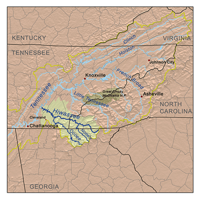
Hiwassee River Map

Hiwassee River Map

A report published by the U.S. Dept. of the Interior prepared for the Senate in 1914 entitled, “Indians of North America,” contains a thorough and valuable briefing, not only on the Cherokee, but on all of the tribes that inhabited the eastern part of the country. (The summary of Cherokee history, including their interactions with others in the Midwest, Northeast and Southeast, as well as their wars and conquests begins on page 133.)

The Smithsonian’s bulletin publication, “Peachtree Mound and Village Site, Cherokee, North Carolina” (online) documents archaeological finds at that site, and concludes (though somewhat reluctantly) that although the Cherokee occupied the site for a time, they were not its original creators. This isn’t the only instance where such sites may have been attributed to the Cherokee. Take the case of the ‘cut off’ Uchee town along the Oconaluftee River in Cherokee, NC, which has mistakenly been labeled “the oldest documented Cherokee town in North Carolina.” Talk about usurping another’s identity, apparently, certain North Carolina ‘Cherokees’ have also lately and erroneously claimed to be descendants of the Clovis Culture in their zeal to portray themselves as the ‘oldest humans in North America.’ Would you believe, a film for public television and school classrooms also claimed that the Aztecs and Maya were descended from the Cherokee. Perhaps, someone never went to the trouble to do their homework, or worse, simply has been out to misrepresent Cherokee history, and not necessarily to the advantage of the Cherokee people. It happens. By the way, the famed Battle of Taliwa may well have never happened — no Creek town named Taliwa ever existed.

To quote Capps and Burney, “the Cherokee occupied the upper valley of the Tennessee River, the mountains and valleys of the Allegheny Range, and the headwaters of the Savannah River. Their ‘legends’ told how they had migrated from the ‘west,’ but much earlier than the Creeks.” 

Well, that’s a stretch, … given the fact that the ancestors of the Muscogee Creek, (and certainly the Uchee, and their allies, the Highland Apalache, Chickasaw, and Shawnee), were living there long before the Cherokee arrived. Current research also indicates a very large population of Native American-European hybrids were living in the North Georgia and the Southern Highlands in the late 1600s and early 1700s. They were known as “Cofache” – a broad mix of peoples with greatly varying DNA markers, including English, French, Dutch, Spanish, Portuguese, Basque, Iberian, Peruvian, Mexican, Asturian, Sephardic Jew, Sami, Finnish… Yet much of this information seems to have gone unnoticed, even ignored, like recent reports about the Hitchiti/Muscogee Creek being the ones to exhibit a Maya-Itsate connection, or that even more ancient peoples, the Alekmani and the Soque, who were known as great scholars, historians and physicians, also populated the mountains and hills of North Georgia at one time! There’s even evidence they may have migrated from a region near the Baltic Sea. Go figure.

For the past thirty-five years, I’ve wondered why certain peoples and cultures mentioned in earlier publications like the Capps and Burney book (1972), (and those whom I personally found most provocative) had yet to receive additional notation. It never occurred to me that one possible reason might have been willful ignorance on the part of a few stubbornly conventional academics.

Tamachichi, Creek Delegation, and the Trustees at Westminister Palace by William Verelst - 1734

Tamachichi, Creek Delegation & British Trustees at Westminister Palace  – painting by the artist William Verelst (1734)

Another of Thornton’s articles was entitled, Painting Shows Mayas Living in Georgia in 1734. (Artwork shown above.) The article discussed the physical/genetic characteristics of the group of Savannah River Uchee, and Muscogee Creek who shared the area at the time of Oglethorpe’s landing, as illustrated by the painting done in Westminister Palace by William Verelst depicting Mikko Tamachichi’s delegation of Creek leaders to meet British officials in 1734. (By the way, some Uchee descendants are still living in coastal Georgia and South Carolina today.)

Thornton’s observations were extraordinary, and altogether believable. Toward the end of the article, he reminded us, The Uchee, Apalache and Itsate all told early British settlers that the first place <their ancestors> lived when they arrived in their current homeland was the general vicinity of Savannah. High King Chikili told the settlers that ‘our first emperor is buried in a mound near Savannah.’ ” (The Bilbo Mound)

The people who were living in the low country at the time Oglethorpe met them in February 1733 knew their history well, and freely related it to the British. It’s possible their Uchee and Siouan ancestors were the aboriginal peoples of the southeast who had previously come from other parts of the world to populate locations across prehistoric North America, so I fully expect to find more written about them in the future.

Lookout from the Slope

Fort Mountain Northeastern View

Getting back to the subject at hand, a single sentence on page 17 of the first chapter of Coastal Georgia explains what the Cherokee say took place during their ‘conquest’ of North Georgia. It reads as follows:

“They {the Cherokees} insisted they had driven out a ‘moon-eyed’ people who were unable to see at night.” 

Do what?

For a book that was published in 1972, that was saying a lot, and in a day before internet search engines could quickly place whatever additional information might be available at the tip of one’s fingers or the end of one’s nose, it was hardly enough. But after long hours at the library failed to produce enough substantial information to venture an educated guess, I set that goal aside.

Eventually, a number of theories surfaced, however, and several years ago, I stumbled upon some information that had been supplied to the public at the Georgia State Parks Fort Mountain website.

Fort Mountain Plaque Near Stone Wall

Fort Mountain Plaque Near Stone Wall

The park is just west of Ellijay near the Cohutta Wilderness at the edge of the Chattahoochee National Forest. Several autumns ago, my friend and I visited the mountain, and spent the day hiking up and down its scenic pathways, taking photographs, navigating the ancient stones along the summit, and all the while feeling like we were treading upon a special, and genuinely eerie … place.

The stone wall at Fort Mountain dates back to 400 A.D. (Some researchers say 500 A.D.) From previously discussed indications, either way that’s prior to the major dust event that wreaked havoc upon the Northern hemisphere, and over five hundred years before the Viking Norseman, Leif Erikson is said to have reached Newfoundland, and almost a thousand years before Columbus sailed. With all due respect, that pretty much eliminates one currently preferred theory that the wall was constructed by the Welchmen, Prince Madoc, whom some believe established a colony in the American Midwest, and perhaps in the Carolinas, about 300 years before Columbus touched these shores. (As far as that goes, it’s definitely before the arrival of the Cherokee. LOL!) By the way, the Knights Templar were not around until the 12th century, and while the Chinese monk, Hui Shen may have visited the Pacific Northwest during the mid 5th century, it’s highly doubtful that he made it to the Southeast.

It’s also doubtful that the wall which zigzags between elevations of 2750 to 2760 feet along the mountain’s southern and western crests was ever used as a fortification — it’s neither strategic nor substantial, and if it was built during the Middle Woodland period, a time when the wide-ranging Hopewellian Sphere, and the Fort Ancient Trade Networks were still providing broad interaction and cooperation between tribes from many regions. Why would it need fortification? And it isn’t the only structure of its kind in the Southeast. Similar field stone walls have been discovered at Alec Mountain (Habersham County), Ladd Mountain, (Bartow County), Pigeon Mountain, (Dade County), Rocky Face, (Whitfield County), Sand Mountain (Catoosa County), Stone Mountain (Dekalb County), also, at another Fort Mountain in Union County, as well as Lookout Mountain in Tennessee, and DeSoto Falls in Alabama.

Aboutgeorgia.com: “Currently, most scholars believe that the wall (at Fort Mountain) originated about 500 A.D. and has a spiritual purpose. Many early cultures built structures related to astronomical events. In this case the wall runs east to west around a precipice. The effect is that the sun illuminates one side of the wall at sunrise and on the other side at sunset. North American Indian cultures generally spiritualized the sun and all things in nature. The absence of religious icons at the site actually supports this theory since it was common practice for American Indians to take ceremonial objects with them when they moved.”

More than likely the wall was originally constructed in ceremonial fashion and designed to correspond with special occasions of celestial observance. It’s also possible that its creators and those who occupied the heights were regarded with esteem, rather than considered to be threatening, (at least up until the time newcomers like the Cherokee got there). The site also shows signs of additional occupancy and alterations, so, … it’s not just a question of who built the wall, but of who was occupying it at the time the Cherokees arrived (possibly as late as the mid-1700s), AND who had possibly been there for much longer.

Were they frightful, nocturnal creatures with poor eyesight that lived underground and only came out at night? Remember the Morlocks? Where they Albinos? Or pale-faced, red-haired cannibalistic giants once known as the Allewegi (or Azgen) who fled the British Isles to practice ‘dark arts’ in America? Or perhaps, early refugees from South America who migrated north to escape brutal enemies in Peru and reportedly also had red hair, fair-skins and blue-green eyes? There are tales of tall, friendly extraterrestrials whose offspring were greatly revered, of ancient seafarers whose tell-tale identification symbol is the concentric circle – (Hint: Swedish bronze-age petroglyphs look a lot like those discovered in the Georgia mountains.), and according to Richard Thornton, early French explorers who trapsed around eastern Tennessee claimed to have visited “a tribe of primitive humans/humanoids who were not American Indians, but had lighter skins, short tails, and bodies that were completely covered in hair.” Hmm, sounds like they might have been describing a tribe of what Canada’s First Nation Peoples call the ‘wild or harry men,’ better known as Sasquatch, Bigfoot, Skookum! Down in the lower forty-eight, they’re also called the Grass Man, the Fouke Monster, Momo, and here in the South, the Skunk Ape, the Wood Booger, and the Swamp Monster, just for starters…

So, do any of the above scenarios make sense?

Maybe. At least, they maybe not as far-fetched as you may think …

The quest for a firmer foundation is just beginning.

(*By the way, on Richard Thornton’s new website, The Americas Revealed – ApalacheResearch.com, there’s an authentically thorough article entitled “The Uchee – Everything You Wanted to Know, But Were Afraid To Ask.” It’s well worth a read. AND, on a new YouTube ChannelPeople of One Fire, Thornton regularly publishes his trove of associated research. Since I’ve only scratched the surface in this article, I’d suggest that anyone sincerely interested in the rich indigenous history of the Southeastern United States spend some quality time on Thornton’s sites. The information found there is vital. Enjoy!)
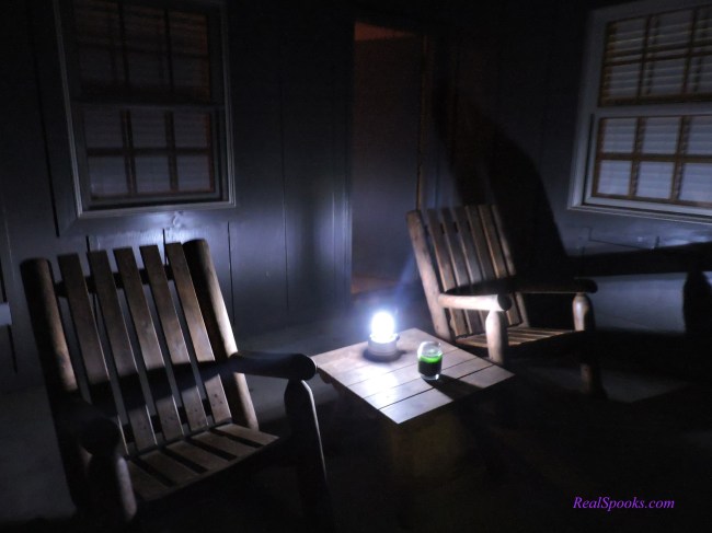
Path Along The Wall - The Stone Seat

The Stone Seat

* * * * * *

Copyright 2015 – 2023, Real Spooks – Cynthia Farr Kinkel

* * * * * 

Tybee’s Dune Man

Tybee Island Ghosts..

* * * * * *

… Up and down the eastern seaboard there are stories about strange ‘entities’ that inhabit the shorelines. From the rocky coasts of Maine to the sandy beaches of South Florida, tales are numerous and varied, and those from Georgia’s barrier islands are no exception.

The Golden Isles, which have stood for centuries against the Atlantic, are nothing more than a series of dunes that have been accumulating one on top of another since ancient times. Anchored by floating mats of sea rack and other debris that gather along the shore, dunes are formed as the ocean’s winds pick up sand and drop it inland from the beach. Year after year, the sand piles high into ridges that eventually collect enough mass to sustain small trees, island shrubs and other vegetation,… tall sea oats, native grasses and weeds.

These newer formations rising along the beaches are not only the first line of defense against the powerful forces of wind and water, they support a unique ecosystem that thrives beneath the shelter of the small trees and underbrush.

At certain points along Tybee’s main shoreline, dunes are so large that they appear as rows of small hillocks running horizontally along the beach with a shallow depression between them. In recent years, the City of Tybee installed wooden cross-overs so that beach goers wouldn’t have to navigate the gulfs.

Micheal Elliott’s book, Running with the Dolphins (1995) specifically references one of these depressed areas as the ‘Valley of the Sea Chicken’  in his chapter about ‘Tenth Street.’  Apparently, locals used to joke that some small creature roamed the dunes at night – most likely, one of their own playing tricks on campfire gatherings or couples petting on the beach.

These days there are restrictions against building fires on the beach, and strict protections for the dunes, but you still hear stories,… and they’re not about the sea chicken.

Tybee has also placed wooden swings on the beach near the end of each of the crossovers. They are seldom vacant, even at night as residents and visitors relax at the edge of the ‘valley’ beside the mesmerizing sounds of the surf, to enjoy the ocean breezes and other ‘extracurricular’ activities.

Facing directly East, with one’s back to the dunes, the sight is particularly captivating, especially on nights when the moon is full and its rising affords a panoramic view of sailing clouds and glistening waves stretching out as far as the eye can see in three directions.

One frequent visitor to the beach used to spend long hours on the swing at the end of Twelfth Street after midnight.  He swears that on several moonlit occasions, out of the corner of his eye, he saw figures running between the surf and the dunes, sometimes farther down the beach, sometimes closer.  He calls them shadow people and says what makes them surreal is the speed at which they streak back and forth.

He admits that eyes can play tricks, but he’s not alone in his descriptions.

Others have seen these figures, especially in the winter when the island is quiet and the beach, deserted. More than one beach stroller has testified they also get the distinct impression they are being followed by someone or something that retreats to the dunes.

One particularly interesting story comes from three young Atlanta friends who were recently spending the weekend on Tybee during off-season. They’d walked to a local restaurant on South End for dinner, and later, after discovering that the moonlight was as bright as day, decided to take a late-night walk back to their rental by way of the beach.

They passed a number of crossovers as they made their way down, and eventually, two of the friends decided to take a short rest in one of the nearby swings. As the third stood facing them while engaged in conversation, he noticed what he thought was a bush moving in the dunes about twenty yards away. At first he shrugged it off, but when suddenly it moved again, he mentioned it, and quietly pointed it out.

His two companions turned to see, but there was no movement.  As the conversation continued, however, the young man kept his eye on the spot.  Sure enough, five minutes later, the bush moved again. This time, he was able to alert his two friends, but as they were poised to investigate, not only did it move, it slowly rose — an expanding, crouching shadow, and began to slide sideways.

The young man described the hairs on the back of his neck standing up as all curiosity drained away.  He and his friends could think of nothing but getting off the beach as quickly as possible by way of the Eleventh Street crossover…

A similar story appears as a  reader’s submission on a site known as GHOSTS AND GHOULSThis one takes place on a night when there was a lot of heat lightning on the beach, but it also describes what appeared to be a dark, transparent figure in the dunes,  ‘a luminous shadow, shaped like a man.’

(More to come)

* * * * * *

Real Spooks © 2012 – 2022, Cynthia Farr Kinkel

* * * * * *

Midnight Strand

Real Spooks © 2012 Cynthia Kinkel

Real Spooks © 2012 Cynthia Kinkel

There’s nothing like a walk down Tybee’s Strand Avenue on a chilly, rainy night in December after the bars and restaurants are closed and the south end is completely deserted. Store fronts rattle and vacant condo facades resound with the echos of pounding breakers just yards away. Not even the island’s feral cats are stirring, as brisk vapors of salty dampness roll in to fill empty streets and parking lots. 

No sugarplum fairies dance around these silent palms, regardless how festively they’re wound – only the howling winter wind off the dark ocean like a wailing banshee on holiday…

Lazaretto’s Lost Souls…

Tybee Island Ghosts…

A Little History

First, it’s important to understand that originally, the Charter of the State of Georgia contained a provision that prohibited the importation of slaves into the new colony. Georgia was to be home to a free (and sober) working class, much like the Yeomen’s class in England, where merchants and craftsmen combined with small farmers to make up the economies of small communities.

Real Spooks © 2012 cynthiakinkel

The founding philosophy was that slave ownership promoted laziness, and a privileged landed gentry. Many of the new Georgia transplants were indentured servants, whose debts had been forgiven back in England. These ‘reformed’ individuals were being given a second chance on the frontier of the Crown’s youngest colony. They were encouraged to value ‘thriftiness and hard work,’ instead of excesses and indulgences. Thus, the Crown did not issue large land grants, as they had years before to the plantation owners of South Carolina. Instead, they appointed Trustees in Savannah as overseers of the common good.

Georgia’s first colonial settlers got forty acres to farm, and merchants and craftsmen were to set up shops in which to trade local goods and services. A portion of all proceeds and profits would go back to England through the Trustees. It sounded like a good plan, at first.

But low country coastal marshes were difficult to farm, and often populated by native Americans, not to mention the subtropical climate was infested with fever-bearing mosquitoes. (South Carolina had dealt with such obstacles and opted to employ slave labor.)

Soon, neither the farmers nor the merchants could make ends meet. Settlers began leaving the new ‘buffer colony’ in droves. The noble experiment envisioned by Oglethorpe and the Trustees was fast becoming a miserable failure. In order to save the colony, the Crown began issuing large land grants to wealthier colonists, but the larger farms could not operate without a substantial, affordable labor force.

In 1749, increasing social, economic, and political pressure forced Georgia’s founding fathers to repeal the anti-slavery provisions in their Colonial Charter. When the act that permitted the importation of slaves was issued, it contained a provision to establish quarantines to combat the risks associated with the influx of imported slaves, as well as the usual threats caused by illnesses from all incoming merchant ships. This reversal of social and commercial policy saved the colony’s economy, but eventually opened up a world of woe.

The quarantine at Lazaretto Creek, however, wasn’t built until 1768, almost twenty years later, on a hundred and four acres of land that had been purchased from Josiah Tattnall the year before. The buildings that housed the sick were constructed on the western tip of the island, at the mouth of South Channel Sound.

Although it served as a ‘hospital’ for less than two decades, it saw scores of unfortunate ‘detainees’ each year due to the span of time in which it operated. Throughout the years of the expanding slave trade, and during the days of the American Revolution, Tybee’s ‘lazaretto’ operated continuously as a holding station for the sick and the dying, until it was found to be completely uninhabitable in 1785. A new quarantine was constructed on nearby Cockspur Island to replace it.

In the days before public sanitation, immunizations and antibiotics, it was often necessary to employ drastic means to keep imported infections from spreading to the mainland.  Anyone who became ill during the voyage to Georgia was subject to quarantine. Whether they traveled of their own accord, seeking freedom or fortune in the new world, or had been transported in chains, lying side by side with hundreds of captive slaves bound for market in Savannah, any individuals infected with a contagious disease like cholera, yellow fever or smallpox were either sent to the quarantine, or the ship on which they sailed would itself be detained in the channel. Sometimes the sick were put in small boats and rowed to the hammocks on Tybee. Sometimes they were tossed overboard to swim.

Once quarantined, these individuals stayed for a certain duration of time, where they either recovered, or died. Accounts vary as to whether it was for a month or four months. A worst-case scenario might be that they didn’t die immediately, or didn’t recover before the ship’s quarantine was lifted, and had to be transported to shore, where they might become infected with something worse, and end up staying, indefinitely.

The present-day Italian term ‘lazaretto, or lazaret’ simply translated means hospital, but in the Middle Ages it literally meant ‘pest house,’ and could actually describe any structure or vessel used as a holding station for people with contagious diseases, or a place for those dying from the plague or from leprosy. Derived from the Hebrew word ‘lazar or leper,’ it also refers to the biblical figure, “Lazarus,” the one whom Christ raised from the dead.

It was not uncommon for creeping ‘killer’ diseases to lurk in such places, and research indicates that remote portions of Tybee’s first quarantine also served as a leper’s colony. No doubt, Lazaretto was a desolate place. 

Today, the western hammocks of Tybee Island are the picture of tranquility at the edge of the largest expanse of salt marsh on the entire southeastern coast. Whatever past scourges or secrets they possess, they bear them in total serenity, and the sunsets are magnificent.

Lazaretto Creek Marina; Memories; Ghosts

Captain Mike Scarbrough and his wife, Iris, first moved to Tybee in 1992, hoping to build a future with their young daughter, Lisa. They bought their property out at the Lazaretto Creek Marina from W.G. Smith, a local resident and fisherman who owns and operates the vessel known as the Agnes Marie, with his partner J. B. Griffle. The premises needed so much work that Iris says her initial response was just to jump in the car and head back to Atlanta. She recalls turning to Mike, and cringing, “Are you sure we really want to do this?” 

The Scarbroughs worked a year or so restoring the docks and the old buildings at the marina while living on their boat, and eventually, converted a small house near the water into a bar with an office. They called it Mike’s Place. According to Iris it wasn’t much to look at, in fact, she says it was ‘a dump’ — if they had five customers on the weekends, they thought they’d been ‘discovered.’ Mike’s Place only served sandwiches, prepackaged snacks, and beer, but the fishing crowd at the docks always appreciated the little bar, and the regulars were friendly. The Scarbroughs continued to reclaim the grounds, and started a dolphin tour business, and over the course of the next decade, things really began to shape up.  A seafood market also opened in another one of the buildings.

The fact that Lazaretto Creek had a few skeletons in its closet was never an issue. However, both Mike and Iris are quick to mention that several strange things happened during the first years they lived on the property.

Photo from Captain Mike & Iris Scarbrough - old Lazaretto Marina docks,1992

There are two incidences in particular. The first took place one night around three in the morning, when Mike happened to look out a back window of the house toward the creek. He thought he saw someone walking around on the dock —  maybe, a couple of people. No one was supposed to be out there that time of night, so Mike went to investigate.

He headed down the plank walkway, ready for a confrontation, only to discover that no one was there. No one was anywhere around. Mike said he stood listening for a few moments to see if he could hear anything, but all was quiet, and there was no sign that any boat had left the dock. “For the life of me,” he says. “I couldn’t figure out where they might have gone.”

The second incident happened some time later when the Scarbrough’s daughter, Lisa, was in high school, and had a friend over from Savannah. They were sleeping in Lisa’s bedroom about three o’clock in the morning, when the friend was awakened with a start.

Glancing around, she said she saw a tall, wide-eyed black man in a tattered shirt, standing in the doorway of the room. She immediately shook Lisa, and the two of them woke Mike and Iris with their screams. The lights came on, but a thorough search turned up nothing. Though it was the last time the stranger was seen inside the house, Mike had to stand vigil for a while so his daughter could get to sleep at night.

In 1995, the marina hosted the U.S. and International Team trials, and in 1996, the yachting events of the Summer Olympics were held there, but it was when Mike took a group from Good Morning America out on the S.S. Dolphin for a tour, that his Dolphin Adventure Tours really took off. Captain Mike and First Mate, Iris, decided it was time to let someone else take over their eatery at the marina.

Joel Solomon moved in at Mike’s Place, renamed it “Cafe Loco,” and added live music on the weekends. Working late hours, after the musicians and the employees left, Joel would soon have his own encounter with the Scarbrough’s eerie night visitor.

Alone in the bar after closing one night, Joel was cleaning behind the counter when he heard a noise and looked up to see a man whom he didn’t recognize standing just inside the entryway — an African American man, wearing strangely tattered clothes. He didn’t come into the bar, but stood there for a moment like he was lost. Joel told him he was closed, and was about to ask if he needed help, when the man turned and slowly began walking as if he were going to take a seat in one of the booths. Joel left the counter to make sure his message was clear, but when he got to the front room, it was empty. The main door which had been secured earlier was still locked. According to Captain Mike, the incident was enough to prompt Joel to search the premises up and down before leaving that night.

There’s been some speculation throughout the years about the whereabouts of the mass grave sites associated with the quarantine. It’s generally believed the old buildings stood in a fairly protected area, near the river channel under the trees. If there were unmarked graves toward the marsh itself, most likely they were washed away by the tides throughout the years. It’s also quite possible that some graves were located where the new bridge now stands, and were unearthed when it was constructed. At the time, bones were reportedly discovered in that location, bobbing up from the ooze.

The Scarbroughs say a group from England showed up a few years back, looking for the unmarked grave of a British soldier whom they believed was buried somewhere on the grounds. Members of the group searched diligently, but it was in vain. Fact is, no remains have ever been located in or around the present-day grounds of Tybee Marina or the adjacent hammock. Considering there was over a hundred acres in the original tract bought from Josiah Tattnall in 1767 — a lot of ground to cover — most locals are doubtful that future searches will turn up anything, other than more speculation.

The ‘ghost’ that paid the three a.m. visits to the Scarbroughs and Joel Solomon hasn’t been seen lately. Iris says it’s probably because of all the ‘live’ activity on the premises at night. Captain Mike’s Dolphin Adventure Tours celebrated twenty years on Tybee in 2012, and these days the little village on Lazaretto Creek near the Tybee Island Marina is flooded with fishing and water sports enthusiasts, tourists and sight seers. Solomon sold Cafe Loco several years ago. Haven’t checked with the new owners of the place, now called Coco’s Sunset Grille, to find out if they’ve encountered anything. Maybe, there are just too many people around these days for a ‘lost soul’ to feel comfortable.

Maybe…

RIP.

* * * * * *

*Copyright 2012- 2023, Real Spooks – Cynthia Farr Kinkel

(*Portions of the above story appeared in the 12/2005 and 01/2006 issues of The Tybee Breeze, published in 2 parts as “Ghosts on Tybee – Song for Lazaretto.” Story appears in its entirety here.)


Song for Lazaretto

Real Spooks © 2012 cynthiakinkel

Tybee Island Ghosts…

“SONG FOR LAZARETTO” – f# minor (copyright Jan. 2001)

1. It runs to the mouth of South Channel, with the tide, it meanders ’round winding its way through the marsh’s waving grasses and soggy ground. It curves like a rippled gray ribbon, the sash on a satin gown, and touches the back of the island on the side where the sun goes down. Many red sunsets have lingered high above this floating plain, to promise relief from the storms at sea – from the waves, the wind, and the rain.

2. The Uchee walked on Tybee long before the Spanish came; … from the Hitchiti-Maya word for ‘salt,’ the island got its name. Though fearsome pirates ventured here whose deeds became renowned, where Blackbeard buried his treasure dear, has never yet been found. While pirate days were numbered, also, French and Spanish gain, the English anchored at Tybee, determined to remain.

3. The founders envisioned Savannah: ‘No tenured property – a viceless, yeoman’s utopia; no rum, no slavery.’ Then trade in Chatham began to fail, and small farms but survived, while over in South Carolina, the rice plantations thrived. As loss and disenchantment overshadowed past convictions, they offered the land grant titles, and lifted the slave restrictions.

4. For years, when ships reached Tybee Light, they’d stop at South Channel Sound. They’d unload the sick and the dying, both the free, … and the bound. They’d leave them here, where this little creek, still far from Savannah town, touches the back of the island on the side where the sun goes down … at a place called ‘lazaretto,’ where a quarantine would hold all the ones with dreaded diseases, and the ones too sick to be sold.

5. While great blue herons nested out beyond the island’s view, mosquito swarms would buzz and bite ’til evening breezes blew. Windswept cedars, and pines, and palms, and crooked oak trees spread … alms of mercy at ‘lazaretto,’ like a summons to ‘raise the dead.’ Though comforters braved the perils, and full moons waxed and waned, there was no such ‘resurrection,’ for the dying who remained.

Refrain 1: Lazaretto! Here, beyond the stormy sea, was no promise for tomorrow, in your sunset reverie? Why must these things be so? What hope can ever be, as we lie here, Lazaretto, to rise again and be free?

6. Now, the South had known misfortune, but the price was high to pay, when the Union armies marched right in, and took it all away. Though Sherman spared Savannah the flames that others knew, the way of life was stricken, … the means of living, too. Great plantations shuttered; fields were laid so low. The slaves were freed, but many stayed. They’d nowhere else to go.

7. But the worst they’d fear on Tybee were the fevers and hurricanes, and soon, the quarantines would close, leaving the last remains of the site where many perished, tide-washed and over-grown, … ’til the rails were laid, and a road was made, and seeds of progress, sown. Nothing survives to mark the graves of the souls lost in that place, … nothing perhaps, but a secret mark, that time cannot erase.

8. Today, the bridge that spans the creek affords a scenic view of the waters off Cockspur Light, as they rush to the ocean blue. Here, the island ‘shrimpers’ dock, and nearby, dolphins play, while hungry seabirds circle low to scavenge what they may … and out on the west horizon, where the miles of marshes grow, the sunsets still do linger as they did so long ago.

9. Many tales are told by those who’ve walked these timeless beaches, and the ways of former slaves live on where the GeeChee culture reaches. The creek still curves like a ribbon, as it winds along with the tide, though it cannot tell a single word how any have lived or died, but at times out here, there’s a sound on the wind, the voice of a memory. It fills the heart of these marshes, like the tide that’s up from the sea:

Refrain 2: “Lazaretto, … many things should never be as the deeds and reasons sleeping pen the pages of history. Yet, there is no doubt as the years rush out to meet eternity, they that lie here in the depths below, … asleep in mystery ….

10. … Will also hear that trumpet blow beyond the stormy sea. Down, … where your waters flow, the day you set them free. Down, …where your waters flow on the sundown side of Tybee. Like a witness, Lazaretto, you wait so patiently – a witness, Lazaretto, wait and see.”

* * * * * *

Copyright 2012 – 2022, Real Spooks – Cynthia Farr Kinkel

A Chill in the Basement… and a history lesson.

Palm-sunset

“SONG FOR LAZARETTO” (copyright 2001)

Tybee Island Ghosts…

After researching the history of Tybee’s Lazaretto Creek some years ago, I wrote an article for The Tybee Times called,  “A Lazaretto Primer,”  … also wrote a poem that later became a song which incorporates an interpretation of that history. 

I don’t presume to know any particulars besides what’s written here, and of course there may be others on Tybee and elsewhere who can add more accurate details.

Some have labeled the following tale a “ghost story.” I agree, for as the bitter cold of Ohio’s winter in 2001 piled snow high outside our basement windows, I had what some might describe as a ‘visitation.’ The encounter caught me off guard, and whatever happened, it cured my writer’s block once and for all. Never again will I put off writing when such inspiration calls.

This story has been revised twice and appears on other sites with updates. The events are true, but since feelings are subjective, I’ll let the reader decide between fact and fiction.

It was January 2001, on the eve of the death of my family friend and mentor, Emma Kelly, Johnny Mercer’s “Lady of 6000 Songs.” John Berendt’s novel, Midnight in the Garden of Good and Evil devotes an entire chapter to this beloved local character. I was in the basement of our Silver Lake home carrying out a New Year’s resolution to clean out my desk. While sorting through junk mail that had accumulated in the middle drawer, I noticed a small blue pamphlet brought back from Tybee Island the summer before. It was a folksy promotional piece picked up at the Tybee Lighthouse gift shop, and it provided a pleasant diversion from the howling blizzard outside. To my surprise, it mentioned a ‘quarantine’ that had once operated on the far west side of the island. Though I’d grown up in the region, and paid many visits to Tybee, this was news to me. Of course, it wasn’t the most documented of local attractions.

It hardly takes a snowstorm — I’d choose research over cleaning any day — to get out my southern history books, and begin an online search. I ended up spending the rest of the evening, and much of the next day at the local library, delving into the fascinating history of Georgia: Savannah and Tybee Island, in particular, including the presence of the Spanish, the native Americans, the pirates, and events surrounding the Civil War between the states.

The pamphlet had specifically mentioned the ‘Uchee’ Indians (Euchee/Yuchi). I’ve since learned that while it’s true that the word “Tybee” is derived from the word Taube, which means ‘salt,’ the word is actually Itza Maya, Apalache Creek/Itzate (Hitchiti)

The Euchee lived along the banks of the Oconee, and at the headwaters of the Ogeechee, Chatanooga, and Savannah Rivers, and while being associated for a time with the islands of Wahale (or Guale) including Tybee, they seem to have merely adopted the word as their own. The native American hunters who initially inhabited the mouth of the Savannah River were, in fact, “Chicora,” but that’s another story altogether…

Twenty miles east of Savannah, Tybee is the most northerly of Georgia’s Golden Isles. A small strip of land juts westward from the island into a vast area of coastal marshlands. This strip with immediate access to the Savannah River shipping channel became the location for two consecutive quarantines that operated during the late 1700s into the early 1800s.

The first, located on the tidal creek that now bears its name, was simply called a ‘lazaretto.’ At the end of the eighteenth century, it housed unfortunate European immigrants who contracted contagious diseases on board ship during the transatlantic voyage to America. It also served as the ‘welcoming station’ for a host of African slaves who emerged from the cargo holds after the treacherous middle passage.

Like all seaports, Savannah could ill afford contamination of the mainland, so incoming vessels experiencing outbreaks of deadly scourges like yellow fever and cholera were required to unload the sick and cleanse the decks before continuing up river to port. Sometimes they were forced to remain at the mouth of the Savannah River for months before given clearance to proceed.

The present-day Italian term lazaretto, or lazaret simply translated means ‘hospital,’ but in the Middle Ages it literally meant ‘pest house’ – a place for those dying from the plague or leprosy. Derived from the Hebrew word lazar, or leper, it also refers to the biblical figure, Lazarus, the one whom Christ raised from the dead. Research indicates that remote portions of the first quarantine, a 104-acre tract purchased in 1767 from Josiah Tattnall, served as a leper’s colony.

After continuous use throughout the Revolution, in 1785 the Savannah Grand Jury reported the first site in “ruinous condition,” and it was abandoned. A new site was opened across the way on nearby Cockspur Island. I also discovered that in 1954, the Georgia Historical Society placed a marker (pictured below), at the original site’s general vicinity along U.S. Highway 80 East.

That next evening around 9:30 p.m., after everyone else had gone to bed, I returned to the basement and sat down to write. I’d already organized my thoughts into what I decided would be a poem about the history of Savannah, Tybee, and the quarantines. Since I’d never done enough boating around the island or through the marsh to be familiar with specific spots, I set out to describe the place using my imagination as best I could. I’d barely gotten first two lines down, when a strange thing happened. It began as a slight tingle. Then, as if someone had slipped up beside me, and touched me on the shoulder, there was whispering in my ear.

The words were gibberish, but suddenly, I could feel myself standing shoulder-deep, in cold, rushing water. Tall green grasses were all around, and the banks smelled of salt, and much to my horror, I was being sucked down by the undertow. For several anxious seconds, I felt I was drowning. Then, as quickly as the sensation came, it was gone.

I sat there wondering if I were coming down with something, or maybe, I’d had a heart attack, a stroke — whatever it was, it was real. I left the computer to get a drink of water, and a few minutes later, feeling okay, I resumed my seat to read over the words I’d typed:

“It runs from the mouth of South Channel, with the tide it meanders round…”

It wasn’t late, and I was anything but sleepy. I decided to keep writing. In the back of my mind, I’m sure I was also waiting to see what else might happen. Except for the fact that I couldn’t stop before a ten-versed poem emerged, the rest of the night was uneventful.

Next morning, my mom called from Georgia to tell me that Emma Kelly had died yesterday. Now, I don’t believe for a minute this rather clairvoyant experience had anything to do with Emma, other than the occurrence served to mark her passing for me.

Emma Thompson Kelly (Dec. 17th, 1918 – Jan. 17th, 2001)

The strangest thing was that exactly one year later to the day, January 17th, I was crossing the Lazaretto, coming to live on Tybee Island. In the months that followed, I thought about “Miss Emma” every time I passed the Pirate’s House where she’d played at Hannah’s East in downtown Savannah. I also flashed upon that night in the basement each time I passed over the bridge onto the island. I still think about it sometimes.

It wasn’t until 2005, however, while I was working on an entertainment article for a local publication that I learned the spot on the western side of the island where the fishing fleet now docks was definitely considered to be haunted by some of the locals. I’d hoped to start off with the Marshall  house on Officer’s Row for my series on Tybee ghosts, but it was the holidays and the owners weren’t in town, so I ended up visiting Lazaretto Creek.

When folks at the marina claimed to have seen figures with tattered clothing walking out on the docks in the wee hours, I wasn’t surprised. I was told that on two occasions, one such figure walked right into a room, stood and stared in silence, then disappeared. It’s still a mystery, but it definitely qualified as one of “Lazaretto’s Lost Souls.”

If ever a place had reason to be haunted, this might be one. Granted, it isn’t Gettysburg, Hiroshima, or Dauchau, or a place where millions have suffered, and I don’t wish to labor the point, but eighteenth century necessity paid a brief, costly visit to Lazaretto Creek, another lonely little corner of the world, where outcasts perished. For those dying on the outskirts of the New World after traveling across the vast ocean in hopes of finding a better life, it was a terrible fate. Or imagine being torn away from loved ones and homeland, and thrown into the pain and horror of slavery. After languishing in chains in the stench and filth below deck with the rest of your unfortunate comrades, you’d probably have welcomed death, especially if there was no hope of freedom.

Mercifully, the passage of time has restored the natural tranquility of places like Lazaretto, and when it comes to pinning down real apparitions, some might say there’s more evidence of ‘non-human’ activity in the world, than of human ghosts. Still, our common ground holds many secrets as layer upon layer, generation upon generation lays down in the dust of the earth. There are those who believe the earth has a collective consciousness, a recorded memory of everything that’s ever happened here. Maybe some places hold memories that can ‘speak’ to us beyond the obvious. Maybe some ‘hauntings’ are like video recordings. Something triggers the ‘playback,’ … and the memory plays.

The poem I wrote that snowy night in 2001 is an historical tale influenced by what I felt and sensed, and of course, by what I believe. You’ll find it linked to the photo of the sunset above. Try reading it on the docks at the marina some night, and let me know what you think.

* * * * * *

Copyright 2011, The Tybee Times

Copyright 2012-2023, Real Spooks – Cynthia Farr Kinkel